Coastal Ocean Research and Monitoring Program
Real Time Oceanographic Data
![]()
|
Notice to Mariners The Coastal Ocean Research and Monitoring Program (CORMP) of the University of North Carolina Wilmington (UNCW) is seeking the co-operation of all mariners operating in the NC coastal ocean (specifically Onslow and Long Bays) to help safeguard the CORMP buoys and shore based moorings against vandalism. The CORMP buoys provide near real-time oceanographic and weather data necessary for the protection of the marine environment off the coast of southeastern North Carolina. Data from these buoys are used by CORMP and UNCW for ecological modeling, pollution mitigation and response purposes, the US Coast Guard for search and rescue operations, the National Weather Service for marine weather forecasts and warnings, commercial as well as recreational fishermen, pleasure boaters and researchers from around the country. The buoys form an integral part of the southeastern regional coastal ocean observing system, which is part of the national Integrated Ocean Observing System (IOOS). Vandalism to these buoys is a principal cause for loss of data and results in the inability of the above groups to make use of the system at critical times when the environment, commercial livelihoods or human life could be at risk. CORMP requests the assistance of the marine community in helping to safeguard these buoys. There are a number of specific ways in which the marine community can be of service.
CORMP operates two buoys which look identical, ILM2 (Lat. 34 08.4502 Long. 77 42.8901) and ILM3 (Lat. 33 59.4314 Long. 77 21.5840). The CORMP buoys (pictured below) are yellow in color and equipped with an external radar reflector as well as a white flashing light and a suite of metrological sensors. They are 5 feet in diameter and extend 8 feet above the water surface. They are visible on radar at ranges of 1-2 NM depending on weather conditions. The buoys extend below the surface to subsurface sensors and mooring systems fabricated from heavy chain and cable, which could damage boats or fishing equipment.
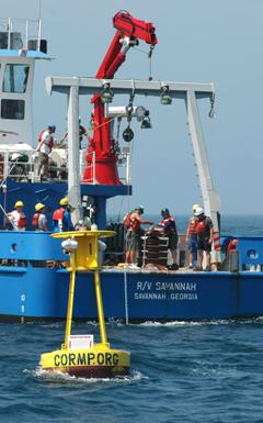
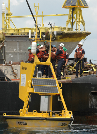
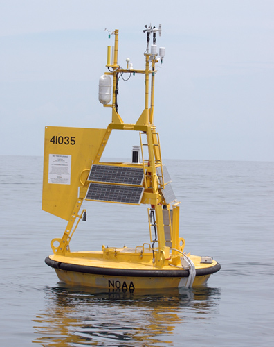
CORMP also purchased a buoy from the National Data Buoy Center (NDBC) – LEJ2 (NDBC #41035) (Lat. 34 28.800 Long. 77 16.800). This buoy (pictured below) is yellow in color and equipped with an external radar reflector and a suite of metrological sensors. It is 6 feet in diameter and extends 10 feet above the water surface. The buoy is visible on radar at ranges of 1-2 NM depending on weather conditions. The buoy extends below the surface to subsurface sensors and mooring systems fabricated from heavy chain and cable, which could damage boats or fishing equipment.
All three of these buoys and the information they provide are a great resource for the people of southeastern NC. They help protect our environment and provide useful information to fishermen, boaters and the rest of the marine community. Please help protect our marine resources. |
|||||||||